Browse Items (510 total)

215 Greeks abandoned this area in 1778.
This dacha consisted of 4,300 desiatinas in or near the villages of Alabash Konrat, Uklar, Topchak.
Boundaries of the 6 uezdy of Tavrida province in 1792
No notes on the size or characteristics of the property included in the 1794 document.
A spot for those who seek out "spectacles of nature." In this case, the spectacle is a waterfall careening from the heights above the fortification. (Uchan-su means "flying water" in Tatar.) A mere 40 minute trip from Yalta brings the visitor to the…
A dacha composed of 2,371 desiatinas (6,401 acres), of which 90% was considered suitable for cultivation.
According to the 1794 report, this dacha consisted of 1,675 desiatinas for raising cattle near Sivash.
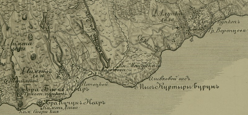
You are looking at a fragment of a topographical map of the Crimean peninsula published in 1842 by the Military-Topographical Depot of the Russian Army. The map was built from the triangulations of Lt. Colonel Oberg and topographical surveys…
A dacha composed of 7 desiatinas (19 acres), of which 88% was considered suitable for cultivation.
Output Formats

atom, dcmes-xml, json, omeka-xml, rss2