Coastal Terrain
Go straight to the annotated map
You are looking at a fragment of a topographical map of the Crimean peninsula published in 1842 by the Military-Topographical Depot of the Russian Army. The map was built from the triangulations of Lt. Colonel Oberg and topographical surveys performed by Colonel Betev 1836-1838. The map consists of 8 sheets, each measuring 54x44 cm., glued on a fabric base. Black and white; relief shown with hachures. [This digitized copy was graciously provided by the Russian State Historical Archive.]
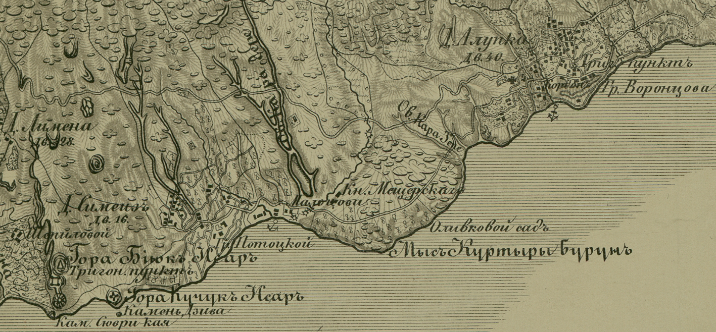
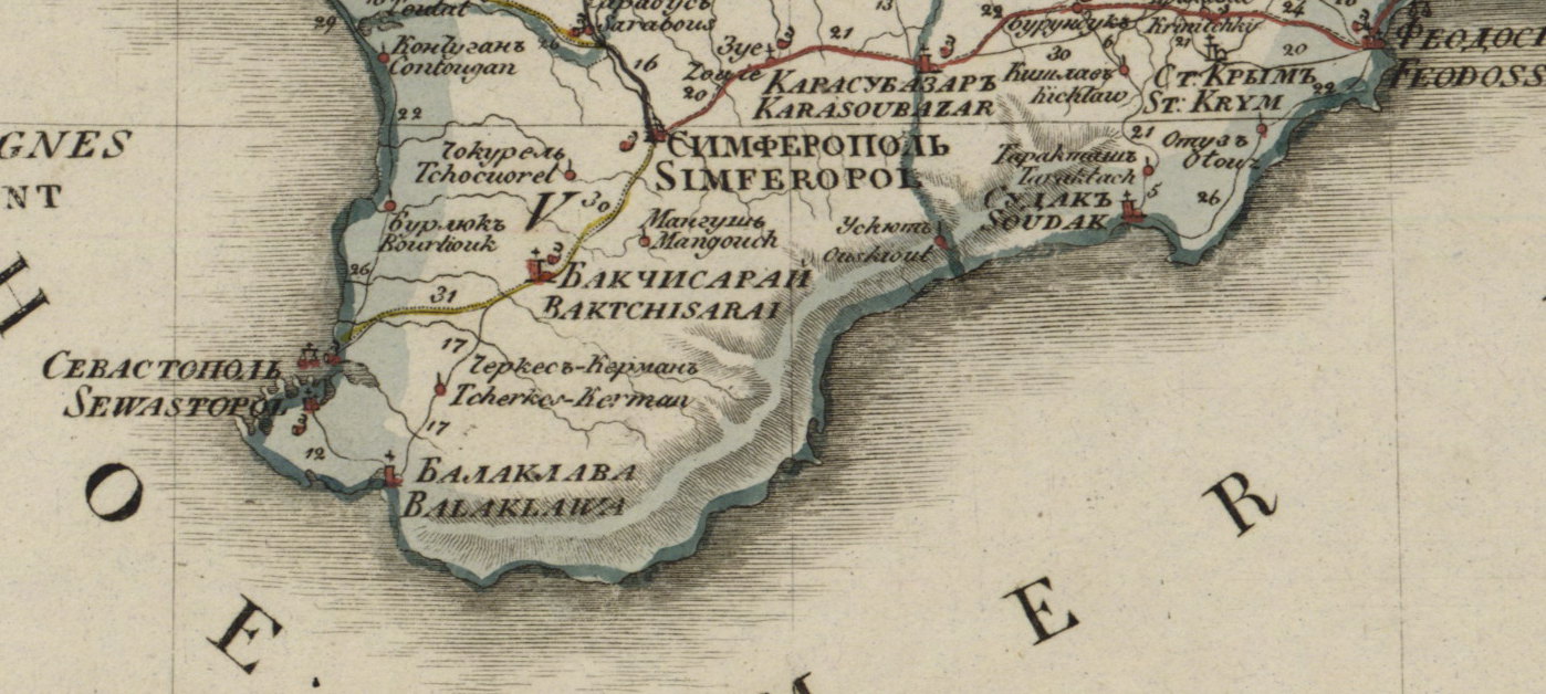
As you can see, the map is richly detailed, with a great deal of attention paid to relief - with peaks and major outcroppings depicted with directionality, and each ravine (овраг) traced with care. The depiction of Crimea's southeastern coastline is all the more striking given the map's scale: at 5 versts (3.3 miles) per inch this is a large-scale map offering far more detail than most maps produced in the 19th century. For example, compare it with the perfectly empty coastline in the well-known and well-regarded "Geographical Map of the Russian Empire" produced in the 1820s by the very same Military-Topo Depot:
Even the topographical map produced in 1817 offers precious little information about what would beome the most famous and choicest bit of Crimean terrain. Here is the same stretch, from Dzvia Rock to Alupka on Mukhin's 1817 map:

One could read the Betev-Oberg map with a multitude of questions in mind. Here I am interested in exploring what we might think of as "the spatial culture" of Crimea.
Navigate through the table of contents at right or simply point and click on the map to see what we might learn from a map produced by men who wielded extraordinary power and in whose hands rested many of the most crucial technologies of imperial rule.