Original Maps (Stills)
Wrinkles in village geography
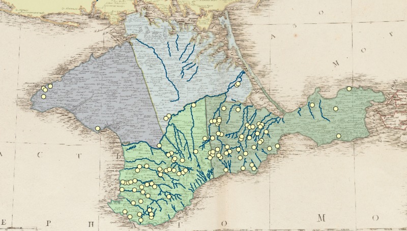
Vil'brekht's map is the best cartographic source I have found for the early post-annexation years. It is quite unique in its almost single-minded devotion to mapping villages, and I took the opportunity to digitize every point on the map, along with the corresponding toponyms.
How good a record of Tatar village geography does it provide? It is hard to say. I can say the the village names taken from the map and those listed in the 1805-1806 registers of inhabited villages (produced by the provincial government) are not a perfect match. 807 of the villages from the registers appear, so far as I can tell, on the map (a match rate of 67%).
The "mislocation" is clear in this map pairing, where villages shown on the Vil'brekht map appear as translucent yellow points. The smaller green points represent villages described in the registers. The second image is a detail map of Feodosiia district, where the match rate was particularly bad. The third image suggests that there was a good deal of continuity (or simply better documentation) along the major rivers such as the Salgir.
The expanding geography of settler dachas
This pair of maps shows the locations of dachas granted to settlers as reported in 1794, and as reported in 1802. Only the properties whose locations I could establish with confidence are shown.

